Key Takeaways:
- Technologies like AI, GIS, and drones are changing how land planning works.
- Data-driven methods improve accuracy, efficiency, and sustainability in urban development.
- New tools are tackling old problems in land use planning.
Introduction
Combining digital tools with detailed land data is changing how urban planning gets done. As cities keep expanding, the demand for efficient, data-driven solutions grows more urgent, and the field is turning to smart technologies to meet it. Planners now have more resources than ever, from drones that map new territory quickly to artificial intelligence that predicts how space is best used. Access to aA satellite map that shows property linesA matters for professionals who need accurate, real-time data while they plan.
Modern planning is not just about building for today. It requires thinking ahead to keep cities livable, adaptable, and sustainable for years to come. Digital tools let stakeholders visualize projects and grasp their long-term effects right away. They connect data with insight, which makes planning more transparent and decisions more reliable. Remote sensing and mapping speed up land analysis, so planners can address risks early and account for environmental and zoning factors. These tools have become central to how the built environment takes shape. With urbanization and climate change reshaping the world, better collection and management of land data matters more every year. Planning today covers land use along with sustainability and resilience for communities of every size.
AI in urban planning
Artificial intelligence lets planners analyze complex datasets quickly and draw useful conclusions from them. AI algorithms pick out spatial and temporal patterns in large volumes of information, including census data, transportation flows, and real estate trends. This helps planners optimize land use, predict urban growth, and flag areas likely to face congestion or resource shortages.
With AI-powered tools, cities can simulate and compare many planning scenarios, which supports better decisions about zoning, infrastructure spending, and even disaster management. Forbes reports that AI’s ability to forecast the ripple effects of proposed developments improves planning efficiency and helps residents directly by allocating resources more sensibly.
GIS and 3D modeling
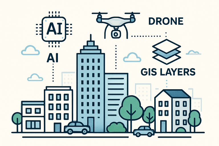
Geographic Information Systems (GIS) are the backbone of data-driven urban planning. They provide layered spatial analysis that shows how different uses interact within an area. With GIS, planners can view zoning boundaries, existing infrastructure, and ecological zones overlaid on property maps. Advanced GIS platforms also pull in real-time data, letting teams model new transportation corridors, utility networks, andA green spacesA with real accuracy.
3D modeling is the next step after GIS work. Adding a third dimension lets planners and stakeholders walk through a proposed development or a whole city block and see exactly how changes to the skyline might affect sunlight, stormwater drainage, or views. Pairing GIS with 3D visualization narrows the gap between data analysis and public engagement, which helps most in contentious situations. The New York Times, for example, has covered how spatial analysis tools guide decisions that affect climate resilience and equity in major cities.
Drones in land surveying
Unmanned aerial vehicles, better known as drones, have changed land surveying. Drones capture high-resolution aerial data, which makes it possible to produce topographical surveys of areas that are hard or dangerous to reach by traditional means. They let planning teams collect current land data faster and more precisely, cutting project timelines and costs.
Drones are especially useful in early planning phases. They can map property boundaries, monitor site conditions, and gather data for real-time 3D modeling. Their imagery matters for projects from new real estate developments to environmental restoration and infrastructure upgrades.
Blockchain for property records
One of the bigger shifts in land data management is the use of blockchain for property records. A distributed ledger creates tamper-proof digital archives, which simplifies title transfers, cuts fraud, and makes it easier for stakeholders to verify property information. Reuters reports that government agencies around the world are testing blockchain systems to modernize and secure public land registries.
In places where property disputes are common or record-keeping is outdated, blockchain offers a transparent, traceable, and dependable option. It streamlines slow bureaucratic processes and frees up resources for other parts of planning.
Challenges and considerations
Progress has been real, but bringing smart technologies into land planning raises problems. Data privacy is a growing concern as more personal and geographic data is collected and analyzed. There is also the digital divide: communities with limited access to advanced technology risk being left behind as smart city projects move ahead.
Money is another hurdle, since upgrading public infrastructure and training staff in new technologies takes serious investment. Using AI ethically and keeping data secure is essential for public trust in these systems. Policymakers and industry leaders need to work across sectors and keep platforms accessible and fair so everyone benefits from these advances.
Land Data and Smart Technologies in Modern Planning
Urban and regional planning has changed fundamentally with the arrival of advanced data systems and smart technologies. Older methods relied on periodic surveys, manual data collection, and static analysis that often left decisions outdated before anyone acted on them. Planning now draws on real-time data streams, predictive analytics, and detailed modeling tools that support dynamic, evidence-based decisions. This shift helps with the harder urban problems: population growth, environmental sustainability, infrastructure strain, and fair resource distribution. Geographic information systems, Internet of Things sensors, artificial intelligence, and big data analytics together give planners new ways to understand, predict, and shape development with precision.
Comprehensive land data ecosystems and collection methodologies
Modern planning depends on data ecosystems that capture the physical, social, economic, and environmental traits of land and communities. Geographic Information Systems (GIS) are the foundational layer, combining spatial data with attribute information to build detailed digital representations of physical environments. Today’s GIS platforms process data from satellite imagery, aerial photography, LiDAR scanning, and ground-based sensors to generate topographic models, land use classifications, and infrastructure inventories accurate to the centimeter.
Remote sensing has changed how efficiently and how often land data can be collected. Satellite constellations now supply daily imagery of urban areas, so planners can track land use changes, construction activity, vegetation health, and surface temperatures close to real time. Synthetic Aperture Radar (SAR) sees through cloud cover and darkness for continuous monitoring in any weather. That is especially useful for tracking informal settlements, spotting unauthorized land use changes, and assessing environmental impacts across large areas.
LiDAR generates precise three-dimensional point clouds of terrain surfaces and built structures. Planners use LiDAR data for flood modeling, viewshed analysis, solar potential assessment, and infrastructure planning. Mobile LiDAR systems mounted on vehicles capture street-level detail, including building facades, utility infrastructure, and transportation assets. This detailed data supports asset management, accessibility planning, and urban design evaluation.
Cadastral data systems are the legal foundation of land planning, documenting ownership boundaries, easements, and land rights. Digital cadastre platforms tie parcel data to zoning regulations, building permits, tax assessments, and transaction histories. Blockchain is a possible answer for creating land registries that cannot be altered, which helps most in places dealing with corruption or incomplete documentation. Smart contracts built on blockchain could automate development approvals when projects meet set criteria, cutting bureaucratic delays.
Demographic and socioeconomic data from census records, mobile phone activity, credit card transactions, and social media offer a read on population movement, economic activity, and community needs. These datasets raise real privacy concerns, but properly anonymized and aggregated data can reveal patterns that traditional surveys miss. Mobile phone location data, for example, maps commuting patterns accurately, identifies transportation bottlenecks, and measures how well public transit investments perform.
Environmental sensors placed across urban areas monitor air quality, noise levels, water quality, and microclimate conditions. These Internet of Things (IoT) networks produce continuous data streams that inform public health work, environmental regulations, and climate adaptation. Combined with meteorological data and pollution source inventories, these measurements support atmospheric modeling that predicts how pollution spreads and identifies good locations for sensitive land uses.
Smart technologies transforming planning practice
Artificial intelligence and machine learning pull useful insights from datasets too large for people to analyze by hand. Computer vision systems classify land use from satellite imagery automatically, catching changes that might signal code violations or informal development. Natural language processing reads public comments on planning proposals and picks out common concerns and sentiment that inform decisions. Predictive models forecast development pressure, gentrification risk, and infrastructure demand from historical patterns and current trends.
Digital twin technology builds dynamic virtual replicas of cities that pair real-time data with simulation. Planners can test policy changes, infrastructure investments, and zoning changes in these virtual environments before doing anything in the real world. Singapore’s Virtual Singapore platform shows the idea in action, with 3D models of every building alongside live data on traffic, utilities, and environmental conditions. Planners simulate scenarios from disease outbreak responses to climate impacts, finding good strategies through computation rather than trial and error.
Participatory planning platforms open the process to broader community engagement through digital tools. Online mapping applications let residents flag problem areas, suggest improvements, and comment on proposed developments from home. Augmented reality apps let people see proposed buildings in their actual locations through a smartphone, turning abstract renderings into something concrete. These tools can draw in groups that planning has long underrepresented, though digital divides still get in the way.
Transportation planning has changed with connected vehicle data, automated traffic counters, and transit smart card systems. These sources give a detailed picture of travel behavior, congestion, and multimodal trips. Machine learning tunes traffic signal timing on the fly based on current conditions, easing congestion and emissions. Simulation models fed with real travel data let planners assess proposed transit routes, road designs, and parking policies before construction starts.
Building Information Modeling (BIM) reaches beyond single structures to city-scale work. These digital representations hold information about building systems, materials, energy performance, and maintenance needs. Tied into urban planning systems, BIM data supports analysis of urban energy use, retrofit potential, and how infrastructure connects. Smart permitting systems check BIM submissions against zoning codes and building regulations automatically, catching conflicts on the spot instead of through slow manual review.
Implementation challenges and strategic considerations
The technology can do a lot, but real barriers slow the spread of data-driven planning. Data fragmentation is the most stubborn one: information sits in incompatible systems across many agencies, which blocks integrated analysis. Legacy systems built decades ago cannot talk to modern platforms, so agencies need costly middleware or full replacements. Setting data standards and governance takes coordination that cuts across bureaucratic lines and shakes up established power structures.
Privacy concerns place real limits on collecting and using data. Weighing the public value of comprehensive urban data against individual privacy calls for careful policy and strong security. Anonymization can break down when several datasets are cross-referenced, which risks re-identifying individuals. European rules like GDPR set strict requirements for data handling that many municipalities find hard to meet. Clear governance that spells out permitted uses, access controls, and retention periods builds the trust needed for people to share data willingly.
Skills gaps hold many planning departments back from using the tools they have. Most planners get little training in data science, programming, or advanced spatial analysis while in school. Hiring data specialists creates interdisciplinary teams but means persuading budget authorities to fund roles without traditional planning credentials. The gap hits hardest in smaller municipalities that lack money for specialized staff or consultants.
The digital divide reinforces inequities when planning moves onto digital platforms. Low-income residents, older people, and communities with limited internet access can get shut out of online participation. Fair engagement means keeping traditional outreach alongside digital tools, which raises rather than lowers the resources needed for real public participation. Algorithms trained on historical data can also carry existing biases forward, so they need careful checking to avoid automated discrimination.
Data quality and reliability problems weaken confidence in technology-driven decisions. Sensor failures, incomplete coverage, and systematic biases in collection produce bad inputs and misleading outputs. Garbage in, garbage out applies with real force to AI systems that can present wrong conclusions with confidence when their training data is flawed. Planners have to keep their own judgment rather than defer blindly to algorithmic recommendations.
Future Trajectory
Smart technologies and land data systems are now part of planning practice, not optional add-ons. For planning departments the issue is not whether to adopt these tools but how to do it fairly, effectively, and ethically. That takes sustained investment in technical infrastructure, workforce development, and institutional reform. Planners should act as informed users and critical evaluators of technology, not passive buyers of whatever vendors offer. Handled with attention to equity and transparency, data-driven planning can produce more responsive, efficient, and sustainable communities that serve all residents rather than a privileged few.
Conclusion
Land data technologies are changing tomorrow’s cities in ways that were not possible before. By combining established planning expertise with AI, GIS, drones, and blockchain, communities everywhere are building more intelligent, responsive, and sustainable places. As these tools keep improving, planners will be better equipped to build resilient cities that balance growth with environmental care and equity, and to deliver smarter planning for everyone.