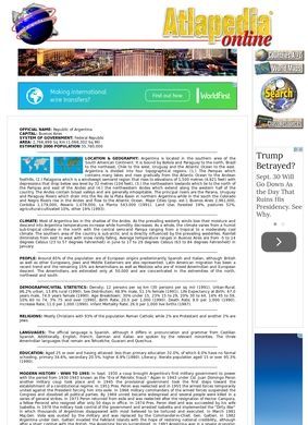
Atlapedia Online is a free reference site that keeps a single country profile for every nation, and the Argentina entry is one page in that set. Land on it and you get the plain skeleton of a country: official name, Buenos Aires as the capital, the form of government, total area, a headcount for the population. There is no scrolling gallery, no cookie wall, no newsletter box. The page states its facts and moves on, which for a reader who wants numbers about Argentina and nothing else is the whole appeal.
What Atlapedia online does well is refuse to pad. The Argentina file reads like an almanac page, and it treats geography as the spine of the country. The Pampas, Patagonia and the Andes each get a mention with a sense of where they sit and what the land does there, and the major cities are named rather than gestured at. Land use is broken down, so you can see how much of the territory goes to crops, pasture and the rest.
Climate follows the same logic, tracing the country from a subtropical north to a sub-arctic south, which is the single most useful sentence anyone can hand a student who thinks Argentina is one weather zone.
The organizing idea across Atlapedia online is consistency. Every country in the collection is poured into the same template, so the fields that appear for Argentina appear for its neighbours in the same order. That uniformity is dull to look at and quietly powerful to work with. It turns the site into a comparison engine, where the labour of matching like against like has already been done for you.
The country profile Atlapedia online builds
The value here is coverage across categories, not depth in any one. A reader gets a little of everything, which is the correct trade for a quick-reference page.
Population and the people behind the numbers
The demographic section is where Atlapedia online earns some trust, because it does not stop at a single population figure. It reports composition, density, an age breakdown, and vital statistics, the birth and death style numbers that let you sketch whether a population is growing or aging. That is more granular than most one-page country summaries bother with. A student comparing Argentina to a neighbour can pull matching fields from each country's file and set them side by side, which is exactly the kind of task these pages were built to serve.
Culture sits nearby and stays brief. Religion, the languages in use, and the state of education get their lines. It is thin compared with the geography, but honest about being a summary. Nobody should come to Atlapedia online expecting an essay on Argentine identity; the page hands you the reference fields and trusts you to go deeper elsewhere.
The legibility of the numbers is the quiet strength here. Because Atlapedia online never buries a figure inside a paragraph of prose, a reader can find the population density or the age split in seconds. That is a small design virtue that pays off every time the page is used for its intended job, and it is the reason the site still gets bookmarked by teachers.
History that stops where it stops
Here is the catch, and I want to be square about it. The history section runs through the political turns from 1930 to 1993: the military regimes, the swings between civilian and armed rule, the economic crises that battered the country across those decades. It is a genuinely useful compression of a turbulent stretch. But it ends there. Anything after the early nineties simply is not on the page, so a reader chasing recent Argentine politics, the later debt story, or any of this century will find nothing.
The page is a snapshot of a country as it was understood at a fixed point, and it has not moved since.
That dating problem is the honest limit of the whole site, and it colours how much weight the economy section can carry too. Atlapedia online gives GNP, trade, the primary products, the main industries, and the export mix for Argentina, which is a solid frame for how the economy is shaped. The structure of an economy shifts slowly, so the categories still teach something. The figures, though, belong to the same older window as the history, and a careful reader should treat them as a starting sketch, not a current balance sheet.
Maps and the infrastructure ledger
The infrastructure block is quietly thorough. Atlapedia online lists rail, roads, the vehicle count, shipping, air transport, communications, and even military personnel for Argentina, the sort of logistics ledger you would otherwise stitch together from three sources. For a school report on how a country moves goods and people, having it in one column is a real convenience.
Then there are the maps, which are the reason to bookmark the site at all. Each country file links out to both a political map and a physical map, so from the Argentina page you can jump to the provinces and cities on one and the terrain and elevation on the other. The maps are clean and readable, and pairing them with the data table beats what most free atlas sites bother to do.
Print the physical map, keep the country file open, and there is a workable one-country study kit. Few free atlases put the data and both map types this close together, and that pairing is the strongest argument for keeping Atlapedia online in a bookmark folder.
Design is where the age shows plainly. This is a spare, old-web page: simple type, minimal styling, headings and blocks of text with no interactivity. Some readers will find that refreshing after years of bloated pages. Others will read the plainness as neglect. Both reactions are fair, and neither changes the fact that the information loads fast and sits still. There is no tracking to dodge and no layout to fight, and on a slow or metered connection the stripped-back build is a genuine mercy.
A search for outside reviews of Atlapedia online does not turn up much; there is no meaningful trail of ratings on the usual platforms, just the page itself and whatever a visitor makes of it.
Who should use it, then. Atlapedia online fits a student who needs a fast, structured country brief and a researcher who wants a single-screen orientation before going deeper. It does not fit anyone who needs current figures or post-1993 events, and it would be wrong to pretend otherwise. The site is a reference tool of a particular vintage, and it is most honest to use it as one.
Set against the CIA World Factbook, the comparison gets sharp. The Factbook covers the same field list, country facts, geography, people, economy, transport, and it is kept current, which is the one thing Atlapedia online cannot claim. What Atlapedia online still offers over that heavyweight is the paired political and physical map on every country, plus a page that is quicker to scan and lighter to load.
For a snapshot orientation on Argentina with maps a click away, Atlapedia online does the job well; for anything that has to be current, the Factbook is the better first stop. Use Atlapedia online for the shape of a country and the map, and go elsewhere for the year's numbers.