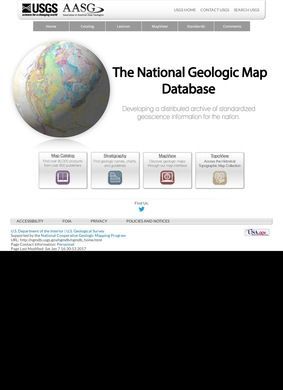
Built jointly by the U.S. Geological Survey and the Association of American State Geologists under the National Cooperative Geologic Mapping Program, the SGS National Geologic Map Database is the country's central index and viewer for geologic mapping. It pulls together work that would otherwise be scattered across federal and state surveys and puts it behind a handful of named tools that each do one job. Anyone who has tried to hunt down a quadrangle map by emailing a state survey will understand why a single front door like this exists.
Map catalog and interactive viewer
At the core of the SGS National Geologic Map Database is the Map Catalog, a searchable index of geologic publications and maps drawn from federal and state geological surveys nationwide. It functions less as a flashy product and more as a reference desk: you go looking for what was published, by whom, and where to find it. For a project pulling from so many separate agencies, having one disciplined index of who published what is the difference between a usable resource and a pile of links. Sitting next to it is MapView, a web-based interactive viewer that stitches geologic maps from many sources into coverage for the whole country. The split is sensible. One tool tells you what exists in the literature; the other lets you look at the geology on screen without first tracking down a physical sheet.
Historical topographic maps
TopoView covers a different appetite. It is an archive and viewer for historical USGS topographic maps going back decades, and it tends to attract a wider crowd than the strictly professional one: local historians, property researchers, people curious how a valley looked before a reservoir filled it. That the SGS National Geologic Map Database keeps this alongside the hard geoscience tools says something about its remit. It is serving more than working geologists, and the historical archive is part of how it does that.
Standardizing geologic nomenclature
Two other pieces are worth understanding because they are about discipline rather than display. The Geologic Names Lexicon is an authoritative reference for North American stratigraphic unit names, the kind of thing that settles arguments over whether two surveys are talking about the same rock unit under different labels.
Geologic Map Schema
GeMS, the Geologic Map Schema, publishes standards and schema so that digital geologic maps are produced consistently across federal and state programs. Neither will impress a casual visitor, but they are the connective tissue that lets independently produced maps line up at all. Standardized nomenclature and a shared schema are unglamorous work, and the fact that the SGS National Geologic Map Database hosts both is a fair sign it takes the plumbing seriously. A business directory of maps is only as good as the rules that keep its contents comparable, and this is where that effort lives.
National mapping status tracking
Rounding things out are the National Geology and New Mapping sections, which track ongoing and recently completed mapping initiatives at the national level. These are more of a status board than a research tool, useful for knowing what ground is currently being covered and what has just landed.
Designed for professional users
Professional geoscientists, state geologists, academic researchers, land-use planners, and government agencies are the core constituency of the SGS National Geologic Map Database, and the toolset is shaped to their habits: precise lookups, standardized names, downloadable map coverage, schema documentation. A member of the public can absolutely use it, and TopoView in particular rewards casual browsing, but the SGS National Geologic Map Database does not soften its vocabulary for a general reader. Stratigraphic units and map schemas are presented as what they are, with no hand-holding. That restraint is part of why the SGS National Geologic Map Database stays trustworthy to the specialists who depend on it; dumbing down the labels would help nobody who actually files or cites these maps.
Learning curve and tool selection
That is a defensible choice for a national reference resource. The cost is a learning curve. Someone who arrives without knowing the difference between a catalog entry and a map viewer will spend a little time figuring out which of the several tools answers their question. The names help once you learn them, though they are not self-explanatory on first contact.
Infrastructure migration in progress
There is a real wrinkle worth flagging plainly. The SGS National Geologic Map Database is currently undergoing an infrastructure migration and openly acknowledges service disruptions during the transition. Credit where due for putting that warning upfront rather than hiding it behind a generic error page. Still, it means a visitor today may hit a tool that is temporarily down or behaving oddly, and that is the sort of thing that turns a quick lookup into a frustrating one. For an occasional user it is a minor annoyance; for a researcher on a deadline the timing is genuinely bad.
Weighing the parts, the SGS National Geologic Map Database is a serious, purpose-built resource that does the dull but essential job of unifying a fragmented field. Most of the heavy lifting happens behind the scenes, in the indexing and the standards, and that is exactly the work that holds up over time. The Map Catalog and MapView cover the everyday need, Geolex and GeMS handle the standards that make everything else coherent, and TopoView is a genuine bonus for anyone outside the profession. The migration is the only thing holding back an unqualified recommendation. If you can tolerate the chance of a tool being offline mid-transition, the SGS National Geologic Map Database points to one of the more useful aggregations of geologic map data the country has. Bookmark it now and expect it to get steadier once the move settles.