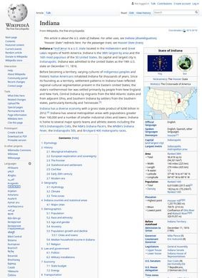
Indiana spent decades letting most of its clocks sit on Eastern time while a wedge of counties along the western and southwestern edges ran on Central, and Wikipedia Indiana lays that quirk out alongside the rest of the state's mechanics without making a fuss about it. That single detail tells you something about the article's temperament. It reaches for the unglamorous facts, the kind that a casual map would skip, and it treats them with the same care it gives the famous bits.
Physical geography of the state
The core of Wikipedia Indiana is a tour through the state as a unit of geography, history and government. Indiana covers 36,418 square miles, which places it 38th by area among the states, and the high and low points are spelled out precisely: Hoosier Hill at 1,257 feet, the confluence of the Ohio and Wabash rivers at the bottom. The borders run against Illinois, Ohio, Michigan and Kentucky. A reader looking for the bones of the place gets them quickly, and Wikipedia Indiana does not pad the numbers with adjectives.
History from ancient settlement to statehood
History gets a long runway. Wikipedia Indiana traces habitation back to Paleo-Indian groups around 8000 BC, moves through European exploration and the Northwest Territory years, and lands on statehood, which arrived December 11, 1816, making Indiana the 19th state in the Union. From there it follows the thread into Civil War participation, the heavy industrialization of the 20th century, and the slower post-industrial economic shift that reshaped many of the manufacturing towns. The timeline does not stop at the photogenic founding moments and keeps going through the harder, less tidy decades, which is the right call for a general reference.
Explaining the state's name origins
The etymology section is short but earns its space. "Indiana" is glossed as "Land of the Indians," and Wikipedia Indiana walks through how "Hoosier," the state demonym, has been traced to Upland South backwoods usage. That kind of word-history is exactly what a general reader tends to wonder about and rarely finds explained, so its inclusion is a genuine service. There is also enough coverage of the state's cultural identity to make the etymology feel grounded rather than decorative.
Population numbers and economic output
On the practical metrics, Wikipedia Indiana holds its ground. The demographics are current enough to be useful, with population given as roughly 6.9 million on a 2025 estimate, and the major metropolitan areas named: Indianapolis as the capital, then Fort Wayne, Evansville and South Bend. The economic figures carry a year too, with gross state product listed at $404.3 billion for 2023 and the leading sectors broken out as manufacturing, agriculture, life sciences and logistics. Dated figures matter for a reference like this, because a number without a year is close to useless, and Wikipedia Indiana generally pins its numbers down.
State government structure
Government is handled at the level a non-specialist needs. Wikipedia Indiana describes the General Assembly as the state legislature, notes the governor, and counts the federal representation: two U.S. senators and nine congressional districts. It also records the administrative grid of 92 counties. None of this is deep political analysis, and it is not trying to be. It is the scaffolding a reader uses before going somewhere more specialized, whether that is a deeper archive, a business directory, or a government database, and for that purpose it is well organized.
Climate patterns across regions
Climate is one of the better-judged sections. Wikipedia Indiana splits the state into a humid continental north and a south that picks up humid subtropical influence, then flags the significant tornado risk that comes with sitting where those systems collide. Seasonal temperature and precipitation detail backs it up. This is the sort of regional nuance that a thinner source would flatten into one line, and Wikipedia Indiana resists that.
Sports teams and universities
Culture and sport get their due without tipping into boosterism. The Indianapolis 500, run as an IndyCar event at the Indianapolis Motor Speedway, anchors the section, joined by the NFL's Indianapolis Colts and the NBA's Indiana Pacers. On the academic side, Indiana University and Purdue University are named as the flagship institutions. The coverage on Wikipedia Indiana is proportional here, which is harder than it sounds for a topic that could easily drown in trivia.
Checking citations and internal links
What gives the entry its weight, more than any single fact, is the apparatus underneath it. Inline citations run through the text, there is a bibliography, and Wikipedia Indiana threads out to related pages on the state's geography, politics, history and culture. That structure is the difference between a page you read and a page you can actually use as a starting point. Follow a citation and you leave the summary for the underlying source; follow an internal link and you drop into a deeper article on, say, the state's political history. Wikipedia Indiana is built to be a hub, not a dead end.
There are limits worth naming, and they are limits of the format rather than failures of this particular page. A statewide overview compresses enormous variety into a few thousand words, so the 92 counties become a number and the post-industrial story becomes a sentence or two. Anyone needing the texture of a specific city, the detail of a single election cycle, or the granular economics of one sector will have to follow the links outward. Wikipedia Indiana seems aware of this and points the way, which is the honest thing for a summary to do.
It also wears its currency on its sleeve. The 2025 population estimate and the 2023 economic figure are not buried; they sit where a reader can see how fresh the numbers are and judge accordingly. That transparency about vintage separates a reference you can trust from one you have to second-guess, and it is one of the quieter strengths of Wikipedia Indiana.
Where Wikipedia Indiana is most convincing is in the breadth-to-depth ratio. It covers etymology, the physical map, ten thousand years of human presence, climate, people, money, government, sport and education, and it keeps each section short enough to scan yet sourced enough to chase. A student framing a report, a traveler orienting before a trip, a journalist needing the GSP figure with a year attached: all three are served by the same page without it bending toward any one of them. The Indianapolis-centric facts, the capital, the speedway, the Colts, the Pacers, sit beside the Fort Wayne and Evansville and South Bend mentions in a way that keeps the whole state in frame instead of collapsing it into its largest city.
Wikipedia Indiana is a fast, defensible orientation to the state and a set of doors into the specifics. It hands over the founding date, the area rank, the river and the hill, the population, the product figure, the counties and the time-zone split, then gets out of the way and lets the citations and internal links carry a curious reader onward. The Hoosier Hill elevation and the Eastern-Central time divide are the kind of specifics that stick, and they are sitting right there in the text.