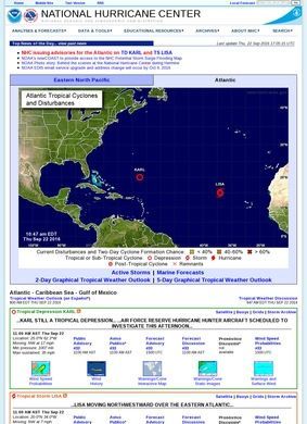
When a hurricane is bearing down on the Gulf Coast and you want to know where it will actually make landfall, the cone of uncertainty you see on every news broadcast traces back to one place. The National Hurricane Center is the federal source that produces those forecasts, and almost every storm graphic that circulates during an active season originates here before anyone else gets hold of it. That single fact tells you most of what you need to know about why the site matters: it is the upstream, not a repackager.
NOAA's role in tropical cyclone forecasting
Run by NOAA, the National Hurricane Center carries responsibility for tropical cyclone forecasting across the Atlantic basin and the Eastern Pacific, with the affiliated Central Pacific Hurricane Center handling the Central Pacific from Honolulu. The core of the operation is the steady stream of advisories: real-time tropical cyclone updates, storm track forecasts, and graphical tropical weather outlooks refreshed on a regular schedule for all three basins during the season. Official watches and warnings are issued from here, along with wind and storm surge forecasts and the post-storm reports that pick apart each system after it has passed. The National Hurricane Center does the formal job first and the public-facing presentation second, which is the right order for something this consequential.
Data and tools for hurricane analysis
The Data and Tools section is where the site stops being a forecast bulletin and becomes a working instrument. It carries aircraft reconnaissance data straight from the NOAA and U.S. Air Force hurricane hunter flights, the planes that fly directly into storms to take measurements that satellites cannot get. Alongside that sit tropical analysis tools, interactive tracking maps, storm surge and wind calculators, and satellite and radar imagery. For anyone who has only ever seen the simplified version on television, the depth here is a step up, and it is the part of the site I find myself returning to because it shows the raw inputs behind the headline forecast. Marine forecasts covering offshore and high-seas zones round out the operational material, which is the sort of thing a captain plotting a route well out from shore genuinely depends on.
Serving multiple audiences effectively
The honest answer is that the National Hurricane Center serves several audiences at once, and it manages to do so without watering any of them down. Coastal residents get preparedness guidance and plain-language outlooks. Emergency managers get the watches, warnings, and surge data they build evacuation decisions on. Mariners and aviation interests get the marine and offshore products. Meteorological professionals get the reconnaissance feeds and analysis tools. A site trying to be everything to everyone usually ends up a mess for all of them, but the National Hurricane Center avoids that trap by keeping the technical material and the public material in separate, clearly delineated places.
That separation is what makes it usable in a crisis. A family checking whether to board up the windows is not forced to wade through aircraft dropsonde data, and a forecaster looking for that same data is not stuck behind a simplified consumer view. The Spanish-language forecast products published alongside the English versions extend the reach considerably, given how much of the population in the most storm-exposed parts of the country reads Spanish first. That is a practical decision about who actually lives in the path of these storms, and the National Hurricane Center has clearly made it deliberately.
Educational resources and historical records
The educational material deserves its own mention because it is built to outlast any single storm season. There are hurricane preparedness guides, a clear reference for the Saffir-Simpson Hurricane Wind Scale, climatological data, historical storm summaries, and a set of FAQs that answer the questions people actually ask. The archives of past advisories and seasonal summaries turn the National Hurricane Center into a record as well as a live feed, which is useful for researchers, journalists, and anyone trying to understand how a region has been hit over the years.
Blog and social media presence
Two things stop the National Hurricane Center from feeling like a purely transactional government portal. One is the blog, "Inside the Eye," which explains the reasoning behind forecasts and the science of how the agency works, written in a register that a non-specialist can follow. The other is the active presence on Facebook, X/Twitter, and YouTube, which matters during a fast-moving event when people are checking their phones rather than loading a desktop site. These channels are not the point of the operation, but they extend it sensibly to where attention already is.
Design priorities during active storms
If there is a critique to make, it is one of form rather than substance. The site is dense, and during a quiet stretch a first-time visitor can find the sheer volume of products and acronyms a little forbidding. The design is functional and reliable in the way government weather sites tend to be, prioritizing uptime and clarity of data over visual polish. For the job it does, that is a defensible trade. When a major system is approaching, you want a page that loads and tells the truth, not one that wins design awards. The structure rewards a little familiarity, and most people who rely on it learn its layout quickly enough.
What sets the National Hurricane Center apart from the many weather sites that exist downstream of it is provenance. The interactive maps and surge calculators draw on the same official watches and warnings that drive national emergency response, so the forecasts here are not an interpretation of someone else's call. They are the call. The climatological and historical material gives that authority depth, letting a reader place a current storm against decades of record instead of reacting to it in isolation. Few resources in any field can claim to be the origin point for their entire downstream ecosystem, and that is precisely the position the National Hurricane Center occupies for tropical weather in the United States.
Authority across three ocean basins
It is worth noting how broad the practical coverage runs. The combination of Atlantic, Eastern Pacific, and Central Pacific responsibility means a single agency footprint stretches from the Caribbean across the open Pacific, and the National Hurricane Center reflects that without making any one basin feel like an afterthought. The same advisory discipline applies to a system threatening Florida and one tracking near Hawaii. That consistency is part of why professionals trust the products: the format and the rigor do not change depending on which ocean is producing the storm.
Bookmark the National Hurricane Center before the season turns active. Spend twenty minutes with the preparedness guides and the Saffir-Simpson reference while there is no pressure to act. Knowing how to read the cone graphic and the surge forecast in advance is worth far more than scrambling to interpret them as a storm closes in. Mariners and emergency planners should go straight to the marine forecasts and reconnaissance data. The published record across decades of Atlantic and Pacific storms, the depth of the data tools, and the institutional standing of the agency all point the same direction: this is the place to start, and in most cases the place to stay.