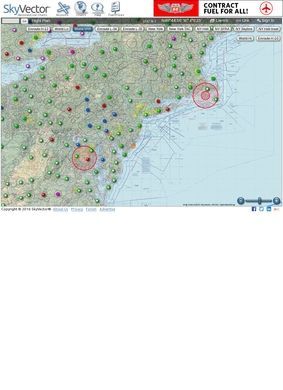
A pilot planning a cross-country flight needs a few things in one place: a current sectional chart, a way to plot the route, airport frequencies and runway data, and some sense of what airspace or hazards sit along the way. Free Online Aeronautical Charts pulls those pieces onto a single moving map that pans and zooms the way any web map does, except the tiles underneath are FAA VFR sectionals and IFR enroute charts instead of roads and satellite imagery. You are looking at the same charts you would carry in the cockpit, only stitched together and searchable.
VFR sectionals and IFR enroute charts
The charting side splits along the lines pilots already think in. VFR sectionals cover the low-altitude visual world, while the IFR low and high enroute charts handle instrument routes and the airway structure above. Switching between them is a click, and the map keeps your position, so comparing what a route looks like under visual versus instrument rules takes seconds. Airport lookups sit on top of this. Type an identifier and Free Online Aeronautical Charts drops you onto the field with the associated information instead of making you dig through a separate database. For anyone who has bounced between a chart, an airport directory, and a flight-planning form in three different windows, that consolidation is the point of the tool.
Airport data and flight plan filing
Route plotting is where Free Online Aeronautical Charts gets used the most. You build a flight plan by entering waypoints or clicking along the map, and the plotted line lays over the charts so you can see exactly what you are flying through: the shelves of controlled airspace, the special use areas, the terrain. The plan can be filed, closing the loop between planning and doing. The plotting interaction feels closer to sketching a line than filling out a government form, which is useful when you are reworking a route to dodge weather or airspace at the last minute.
Route plotting over airspace layers
Two features push Free Online Aeronautical Charts past being a plain chart viewer. The first is fuel pricing shown directly on the map, covering both Jet Fuel and AVGas, with retail numbers alongside contract fuel pricing. Prices are not static either. There is a CSV-submission path so operators and users can feed in fuel prices, and that kind of crowd-maintained data keeps a niche resource current when official sources lag behind actual field conditions. Contract fuel pricing sits behind an account, and help documentation walks through how the feature works, so the login requirement is tied to a concrete payoff rather than a wall for its own sake.
Fuel pricing from crowd-maintained sources
The second is DROTAMs, the Drone Notices to Airmen layer. This surfaces areas where unmanned aircraft are operating, and it has become a real planning input as drone traffic grows near airports and low-altitude corridors. Free Online Aeronautical Charts lets you customize how visible that layer is, so a crop-duster pilot flying low and a jet crew planning an approach can each tune it to what they care about. For the regulatory background, the site links out to the FAA UAS resources instead of trying to paraphrase rules that change and have legal force of their own.
Drone notices to airmen layer
The audience it serves reads straight off the feature set. Private pilots get the sectionals and route plotting. Commercial operators get the fuel-price comparison and contract pricing that actually moves the cost of a trip. Flight schools have a free, browser-based tool they can put in front of students without licensing hardware or software. Drone operators get the DROTAM layer and the airspace picture they need before putting anything in the air. It functions almost like a business directory for fuel prices and airport data layered under aviation charts, and having that spread on one platform is unusual; it holds together because everything hangs off the same map.
Who uses this tool
Free Online Aeronautical Charts asks little before it becomes useful. Most of the charting and planning works without an account at all, and logging in opens up the extras rather than gating the core. That lowers the barrier for a student or a weekend pilot who just wants to eyeball a route, while still giving operators a reason to sign in. The account model tracks with how the tool is built: open where it can be, gated only where the data warrants it.
Account requirements and access
A few rough edges come with the territory. The interface is dense, and a first-time visitor may need a minute to work out which chart layer is showing and how to start a plan. The fuel data depends partly on user submissions, so coverage runs stronger at busier fields than at quiet strips. None of this undercuts the core function. Free Online Aeronautical Charts remains a chart viewer and flight planner first, and it does that job cleanly across the VFR and IFR worlds.
Interface density and data coverage
Free Online Aeronautical Charts covers the planning stage of a flight, from the airport lookup through to the filed plan, without an app purchase or subscription standing in the way. Current charts, working route plotting, fuel numbers that update from real submissions, and a drone-activity layer are a lot to pack under a plain-chart-viewer label. The fuel pricing and DROTAM layers on Free Online Aeronautical Charts are the parts worth returning to, sitting on charts that match what ends up on the yoke in the cockpit.